Extended Learning
A. Congratulations
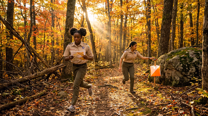
You have earned the Orienteering merit badge — one of the most hands-on, field-tested badges in all of Scouting. You can read a topographic map, navigate by compass bearing, count paces through trackless terrain, and find a hidden flag in the middle of the woods. Those are skills that work when every battery is dead and every satellite is out of reach. What follows are ways to take your navigation even further.
B. Deep Dive: Route Choice Strategy
In competition, the difference between a good time and a great time often comes down to route choice — the path you take between two controls. On every leg, you face a fundamental tradeoff: do you take the shortest straight-line route (which may go through thick brush, over hills, or across unmapped terrain), or do you take a longer route that follows trails, avoids climbs, and keeps you on fast-running ground?
The answer depends on three variables: distance, terrain difficulty, and your confidence in the navigation. A 400-meter straight-line bearing through dense green vegetation (slow running) might take longer than a 700-meter route that follows a trail to an attack point, then cuts in with a short bearing.
To improve your route choice, try this exercise: after an event, look at the master map and identify three to five legs where multiple routes were possible. For each leg, estimate the time for each route option using your pace count and terrain knowledge. Then compare with what you actually did. Over time, you develop an intuition for when the trail route beats the straight-line route — and when it does not.
Experienced orienteers talk about three classes of route:
- Straight (bearing) route: Direct compass navigation. Best when the terrain is open and the distance is short.
- Path route: Follows trails and handrails. Best when the trail network goes roughly where you need and the off-trail terrain is slow or complex.
- Contouring route: Goes around hills rather than over them. Best when the climb is steep and the alternative adds minimal distance.
The best competitors switch between these classes within a single leg — following a trail for the first half, cutting off-trail for the approach. Practice reading the map for route options even when you are not competing. It is a skill that rewards constant attention.
C. Deep Dive: Electronic Timing and Modern Competition Technology
The old-fashioned way to prove you visited a control was to use a pin punch to poke a pattern into a paper card. It worked, but it was slow, error-prone, and impossible to verify after the fact. Modern orienteering uses electronic timing systems that have transformed the sport.
SPORTident (SI) is the most widely used system worldwide. Each competitor carries a small electronic “finger stick” (called an SI card) worn on a finger. At each control, a small station unit is mounted next to the flag. You tap your stick to the station — it records the control code and timestamp in both the stick and the station. At the finish, your stick is read by a computer that instantly produces your split times for every leg, compares them to other competitors, and checks that you visited every control in the correct order.
EMIT is the dominant system in Scandinavia. Instead of a finger stick, you carry a small card with a built-in battery. The punching process is similar — tap the card to the station — but the technology behind it is different.
Timing data has revolutionized how orienteers analyze performance. With split times for every leg, you can see exactly where you lost or gained time compared to competitors. Services like Winsplits and Livelox display your GPS track overlaid on the orienteering map, showing your actual path compared to the fastest routes. This level of analysis was impossible in the pin-punch era.
If you attend a larger event, you will likely encounter electronic timing. The registration desk will assign you an SI card or EMIT device if you do not own one. Rental fees are usually a few dollars.
D. Deep Dive: Contour Interpretation for Advanced Navigation
You learned the basics of contour reading in Req 4a — hills, valleys, ridges, saddles, and depressions. Advanced contour reading goes much deeper and is the skill that separates intermediate orienteers from expert ones.
Contour shapes as navigation features. A subtle bend in a contour line might represent a small re-entrant that is just 3 meters deep. On the ground, it looks like a shallow dip in the hillside. An expert orienteer uses that dip as a collecting feature or even an attack point. A beginner walks right past it without noticing.
Reading slope steepness in real time. As you run, you should constantly match the steepness of the ground under your feet with the contour spacing on the map. If the map shows wide-spaced contours (gentle slope) but you are climbing steeply, you have drifted off course. This continuous slope-matching is one of the most powerful relocation techniques.
Visualizing terrain in three dimensions. Practice looking at a section of contour lines and building a mental 3D model of the landscape before you see it. Can you predict, from the map alone, whether you will see a distinct hilltop to your left when you cross the stream? Will the ground flatten out at the top of the next climb, or does it continue to steepen? The faster you build these mental models, the faster you navigate.
Try this drill: find a USGS topo map of an area you have never visited. Study a 1-kilometer square for five minutes. Write down what you expect to see if you were walking north through that square. Then visit the area (or view it on satellite imagery) and compare your predictions. This builds the visual translation skill that makes contour reading instinctive.
E. Real-World Experiences
Local Orienteering Club Events
Rogaine Events
Adventure Racing
National Orienteering Championships
F. Organizations
The national governing body for orienteering in the United States. Maintains the event calendar, supports local clubs, organizes national championships, and provides resources for beginners and instructors. Your first stop for finding events and getting connected.
The worldwide governing body for orienteering, overseeing world championships in foot, mountain bike, ski, and trail orienteering. Their website offers rules, maps, and results from international competitions.
A nonprofit organization dedicated to supporting orienteering development in the United States through grants, mapping projects, and youth programs. They fund new orienteering maps and support clubs that need resources to grow.
The federal agency responsible for producing topographic maps of the United States. Their free topoView tool lets you download and print topo maps for any area in the country — essential for orienteering practice and course design.